20 May, 1886
NA
The Admiralty
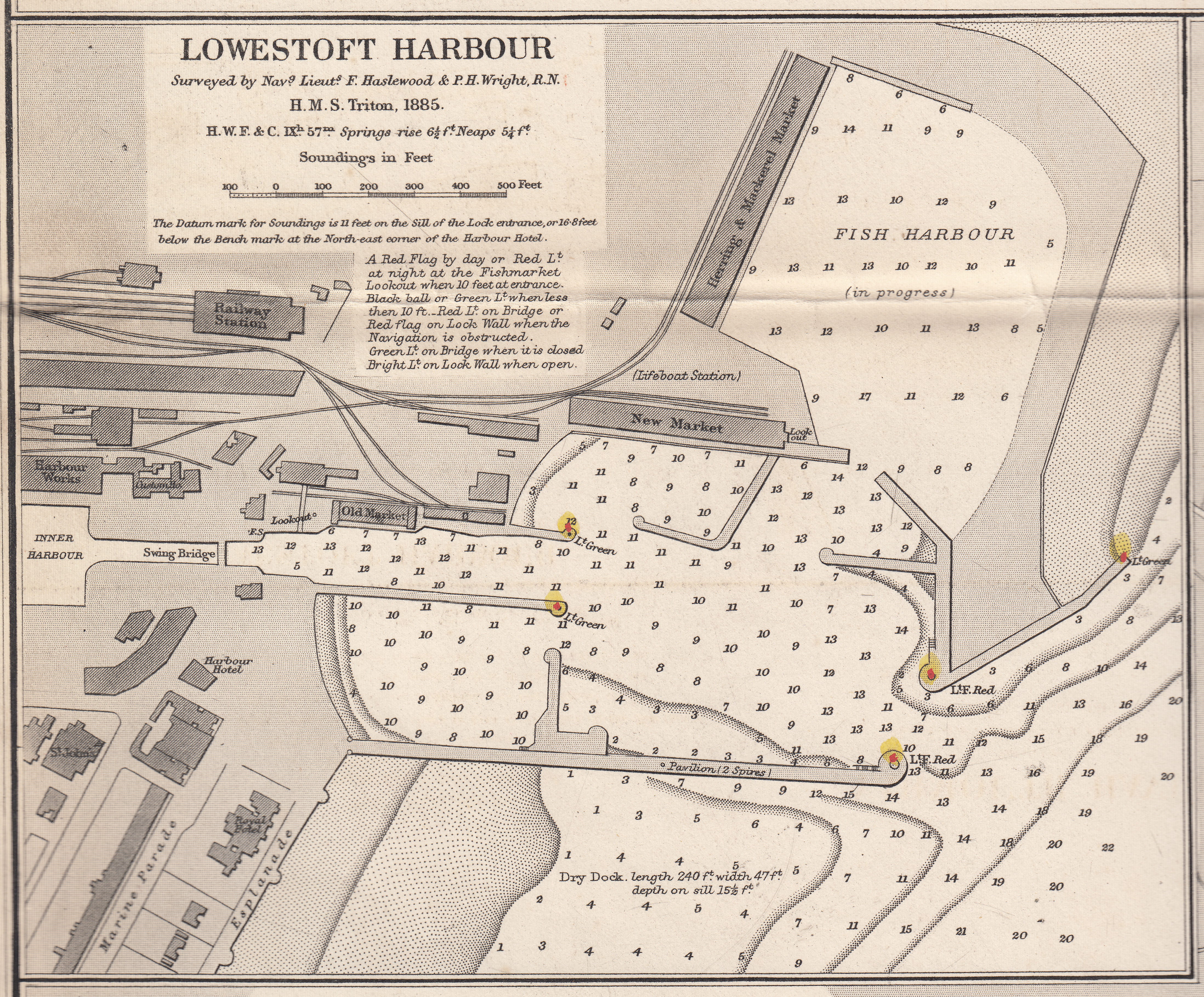
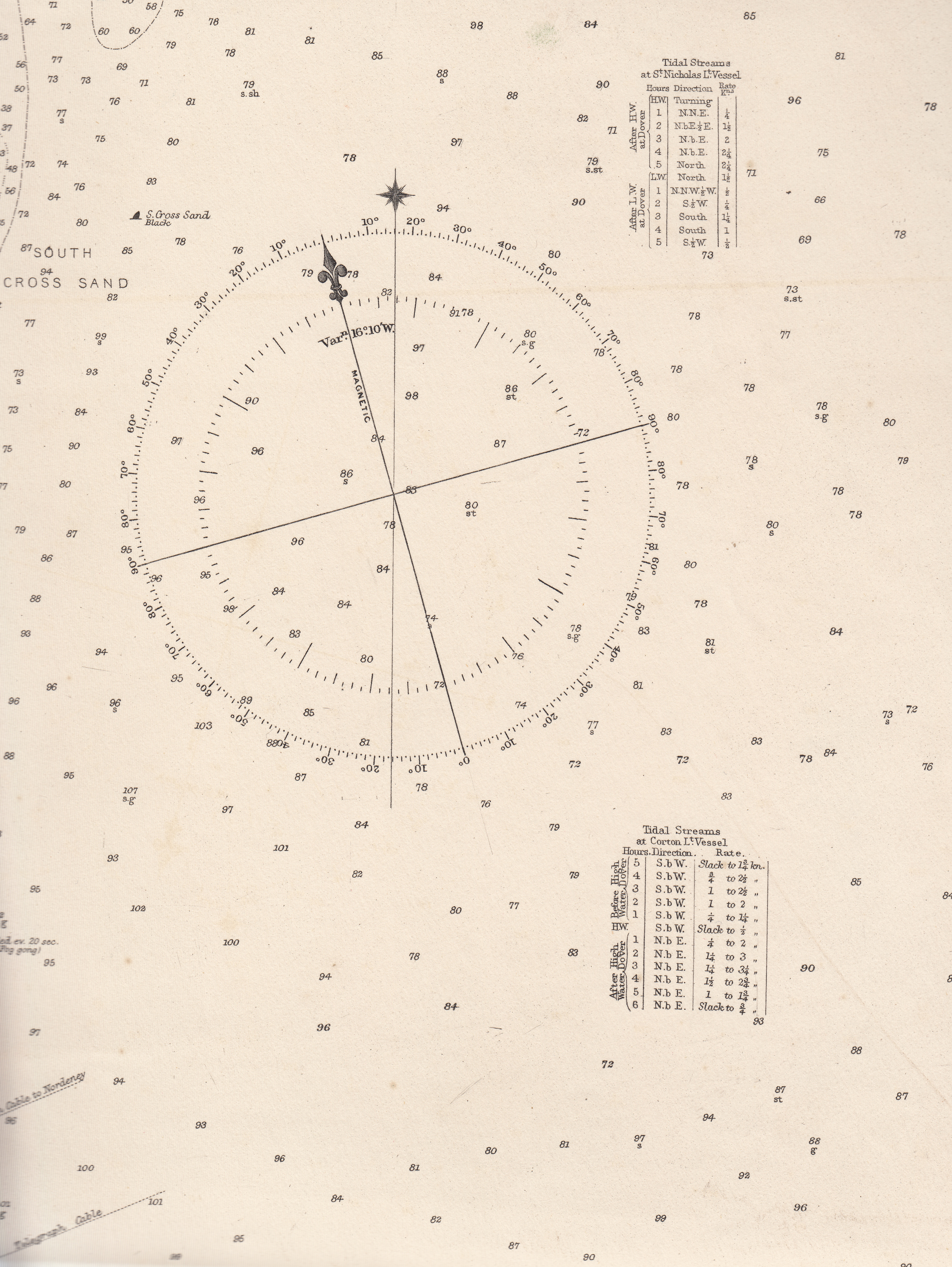
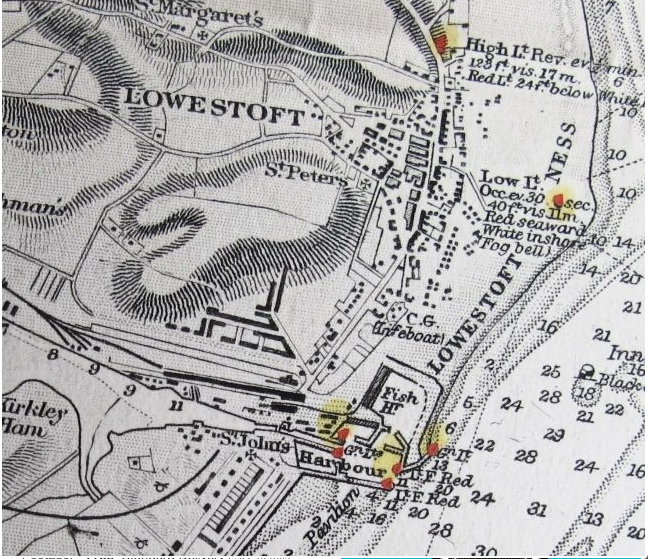
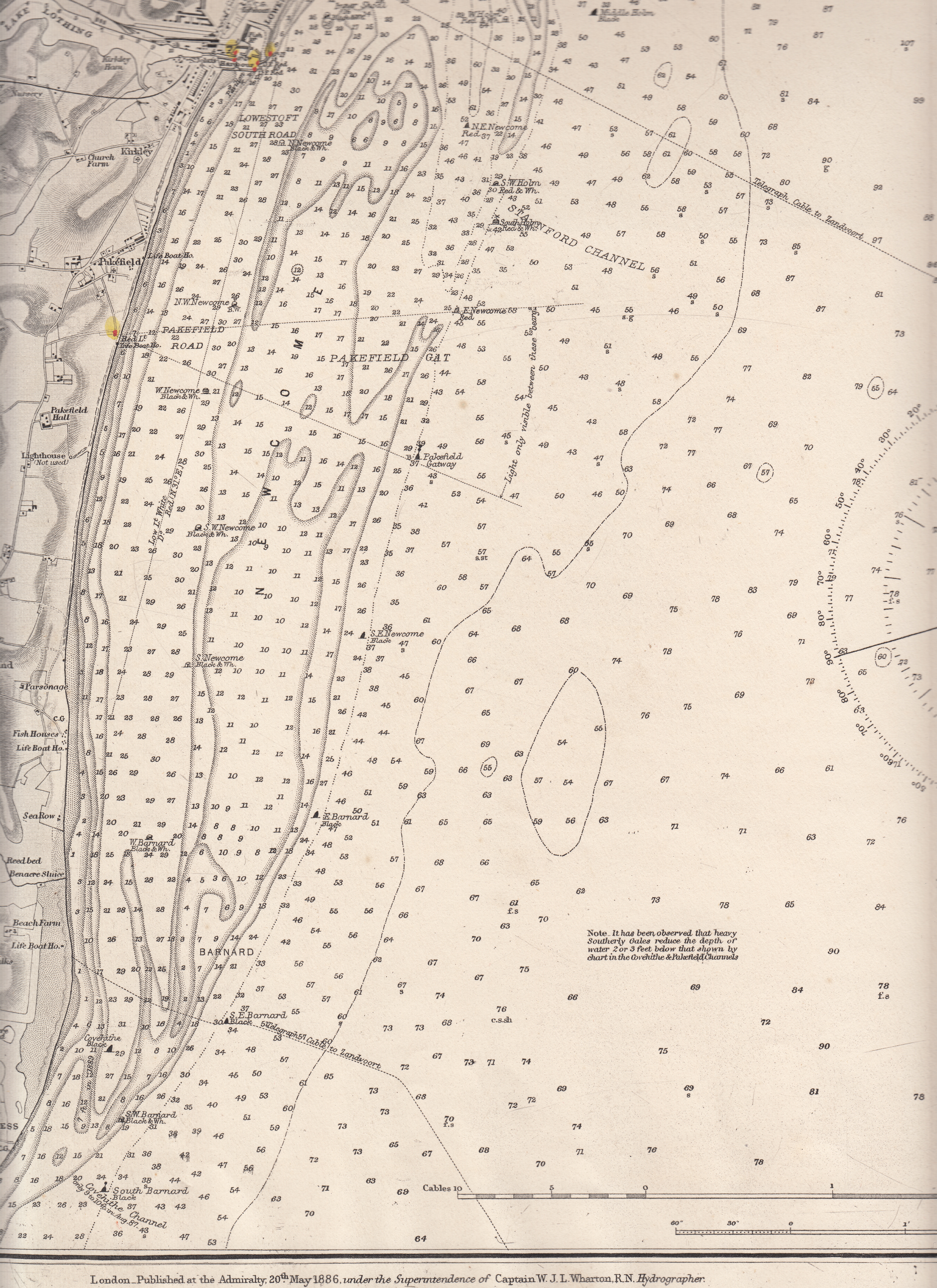
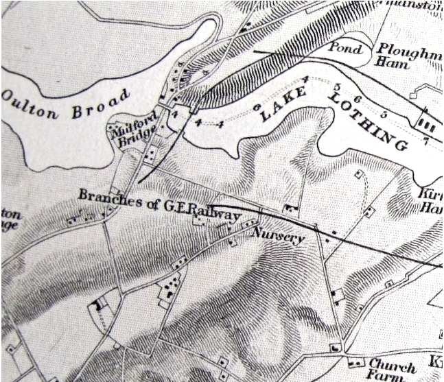
Caption: East England, Lowestoft and Yarmouth Roads
This is a massive map (at least 5' x 3') and I've scanned it into managable portions just so it will download in a reasonable time. It was used by merchant marine and fisherman in their offices because it had not only local roads and landmarks, it had detailed information on sea depths, sandbanks, harbour information, light house information, etc.
If there is a section I didn't scan and you need it for your research, please contact me.